

24 June 2025
Where the Garden Route meets the wild Tsitsikamma coast, the Storms River pours out of a forested gorge into the pounding Indian Ocean. Spanning its mouth is a swaying suspension bridge that has become one of the region’s most photographed and exhilarating short walks. It is the highlight of the Tsitsikamma section of the Garden Route National Park, and one of those rare thrills that almost anyone can enjoy, though as a card-carrying adrenaline junkie, I confess I wanted more.
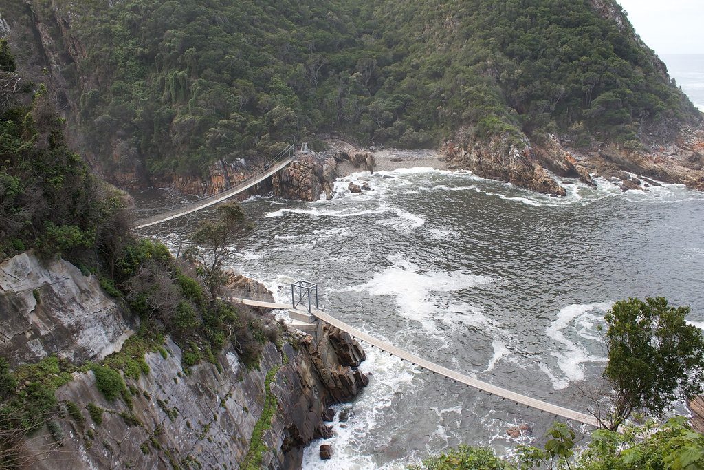
This guide covers the walk to the bridge, the trails around Storms River Mouth, and how it fits into a Garden Route trip.
The Walk to the Bridge
The bridge sits within the Tsitsikamma section of the Garden Route National Park, reached from the Storms River Mouth Rest Camp. From the car park, a boardwalk trail, the short circular Mouth Trail, winds for about a kilometre through coastal forest and along the rocks to the bridge. It is easy going, with the sound of the surf building as you approach and a Khoisan heritage cave along the way.
The main suspension bridge is 77 metres long and sways gently as you cross high above the river mouth, with the sea crashing in on one side and the dark gorge stretching inland on the other. On the far side, a steep climb leads to a lookout with a superb view back over the coast. It is a genuine thrill without ever being frightening, and if you want the real thing, the world’s highest bridge bungee at nearby Bloukrans is just up the road; I couldn’t drive past it.
Good to know: the suspension bridge occasionally closes for maintenance and rebuilding, so it is worth checking current access with SANParks or the official Tsitsikamma information site before you travel.
More Trails at Storms River Mouth
The bridge is just the start. Four short trails radiate from the rest camp, ranging from one to six kilometres:
- Mouth Trail (2 km) to the suspension bridge and back.
- Lourie Trail (1 km), an easy forest loop.
- Blue Duiker Trail (3.7 km), deeper into the indigenous forest.
- Waterfall Trail (6 km), which follows the rugged first stretch of the famous Otter Trail to a waterfall, over slippery boulders that make it the toughest of the four.
Keep an eye out for the endangered African black oystercatcher on the rocks, the shy Cape clawless otter, dolphins in the surf, and, in season, migrating southern right whales. Trail details and reviews are on AllTrails.
Beyond the Trails
The small pebble beach at the mouth is suitable for swimming, and in summer a raft is moored offshore for the adventurous. This is also prime territory for snorkelling and scuba diving on the protected marine reserve. Storms River is more than a bridge, then: it is the gateway to some of the wildest, most beautiful coast in South Africa.
Fitting It Into a Garden Route Trip
Storms River lies at the eastern end of the Garden Route, close to the boundary with the Eastern Cape. It pairs naturally with the pretty lagoon village of Wilderness and the hub town of George to the west, while continuing east brings you toward Gqeberha and Addo. Many travellers drive the whole route from Mossel Bay, making Tsitsikamma a fittingly dramatic finale.
Frequently Asked Questions
How long is the Storms River suspension bridge? The main bridge is 77 metres long, one of three that cross the river mouth, suspended above the water where the Storms River meets the sea.
How do you get to the suspension bridge? From the Storms River Mouth Rest Camp, the circular Mouth Trail is an easy one-kilometre boardwalk-and-path walk of about an hour to reach the bridge.
Is the Storms River bridge suitable for children? Yes. The walk is short and mostly on boardwalks, and the bridge, while it sways, has high sides and is safe for families, though small children should be supervised.
Final Thoughts
The Storms River bridge packs a lot of drama into a short walk. Cross the swaying span, climb to the viewpoint, and linger on the trails, and you will understand why this stretch of the Tsitsikamma coast is such a celebrated finale to the Garden Route.